Having completed Mountain Designs Geoquest and Wildside AR successfully
in 2017, XPD Bay of Fires, Tasmania was next on the AR bucket list for the team
consisting of Alina McMaster who was a member of AROC at the very first XPD in
Broken Hill 15 years ago; Cass Kimlin two time XPD finisher Townsville 2015 and
#ARWS World Champs Shoalhaven 2017; Gina Dunsdon two time XPD finisher Flinders
Ranges 2013 and Townsville 2015; and myself, Kim Beckinsale two time XPD
finisher – Tasmania World Championships 2011 and Flinders Rangers 2013 as a
member of the winning team Mountain Designs. Our goal for this XPD was to
complete the full course successfully, which meant finding every single CP, as
an all Australian women's team, having fun and enjoying the great scenery
Tasmania has to offer along the way! We certainly had a wild time out there, so
here are some of the highlights of our adventure proudly flying the flag for #MountainDesigns
the iconic Australian outdoor adventure gear brand!
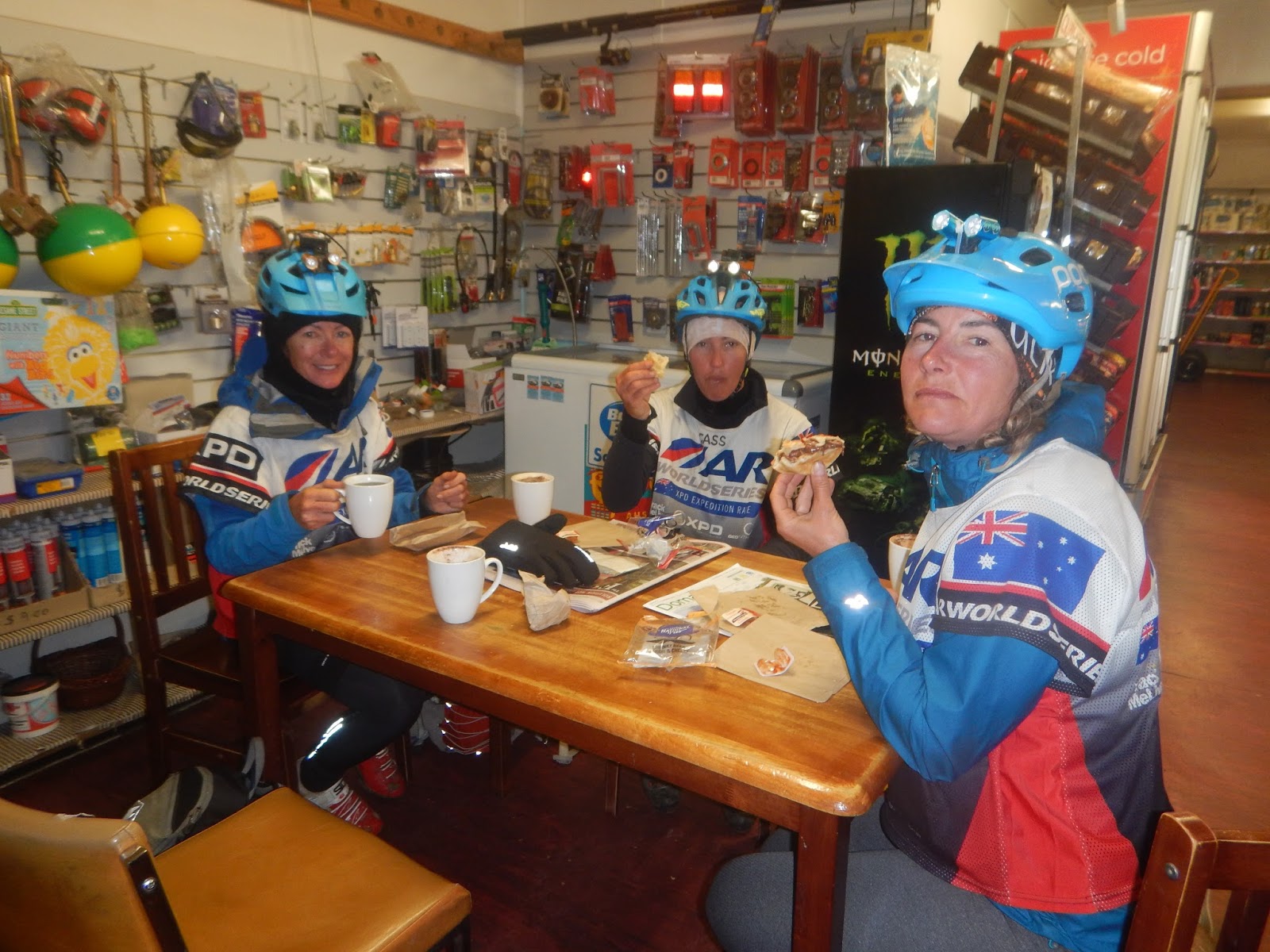
HQ &
Registration-St Helens
St Helens was a pretty cool spot for HQ as it was right on
the water and the place we stayed certainly captured the ocean views perfectly.
Pre-event registrations and checks were at the community hall and as usual a
hive of activity, with gear checks, navigation checks, first aid, safety and
environmental talks taking place, while we mingled with some of the other
Aussie and international athletes also preparing for this epic event. We were excited
not to have to do a competency paddle, however did take the time to work out
the best set up in the CTR Spirit Kayaks we would be using in the event.
 |
| Navigation Checks |
 |
| Jarad Kohlar helps us with Kayak Set Up |
 |
| Cass and Kim take boxes down to HQ after registrations |
The Lockdown – Short
event briefing before the course is revealed and planning begins.
We received our logistics planner 7 days prior to the start
however we only received the maps just 2hrs before we were to board a bus to a
mystery location. So, it was certainly a bonus to be provided with 2 sets of
water proof maps and instructions with each leg clearly labelled across the 24
or so maps, however, it was a real challenge to try to do course planning in
such a short time. Anyway the most important thing we did do was get Alina to draw
north lines on the maps indicating the declination for magnetic north, as Gina
worked on logistics and Cass and I completed some very basic highlighting of CP’s
and proposed routes. Conditions for racing were absolutely wild with severe gale-force
NW winds forecast, this meant that Leg 1 & 3 Ocean & Bay Paddles had to
be cancelled. We were told we would start at a mystery location on Trek Leg 2. In
what seemed like just minutes our planning time had dwindled to seconds and it
was jackets on as we gathered our gear and boarded the busses for a wet and
wild start to #XPD Bay of Fires 2018.
Start Leg 2 Trek – St
Helen’s Point 16km
The mystery location was in the sand dunes north-east of St
Helens however, to get the first CP teams were challenged to work out their
exact location. We could do this and after the mayor sounded the starting horn
we found ourselves running just behind the Tri Adventure Antelopes...being able
to move fast here was a bonus as we had about 4 teams all looking for the same
CP's on stakes in the dunes! Soon we were coasteering and settled our speed
down as the field started to spread out, despite the wind and rain we enjoyed
this leg and within 2 hours were at the TA ready for Leg 4.
Leg 4 MTB – Flag Staff
Hill 22km
It was bucketing down with rain and the wind was almost
blowing us sideways off the road as we started the leg, so in a way we were
relieved to hit the hills in the bush. CP 6 was on a tower, so we were treated
to hike a bike number 1, then our route choice to CP 7 involved both a down
hill hike a bike and then a steep hike up, oh well at least we were in the
right spot! A flat tyre at that point put us back a bit and tested our team
work skills, yet soon we were one again riding some pretty steep forestry
trails towards CP 10 the final CP on this leg. We thought our route choice was
not great, however arrived at the TA in around 4th spot!
Leg 5 Paddle –
Scamander River 13km
The sun was now shining on and off, so conditions were
looking good for our first paddle of the event. The TA was in a nice sunny spot
and it looked like we would finish the paddle in the light, so jackets on but
no extra paddle gear was really required. This paddle on the Scamander River I
had previously done in the Mark Webber Challenge, so it was somewhat familiar
as we got going and I remembered we did not want to get sucked into the lake,
so hugged the left bank. There were a few portage possibilities however as we
could not tell the difference between private property and forestry we opted to
stay in the boats and paddle. Just towards the end the water seemed to run out
so it was a bit of a boat drag up to the TA, however we were excited to see
some familiar faces at the TA – Steve, Shan & Dyson, however not too much
time to chat as the light was fading and we wanted to get out on the bikes!
Leg 6 MTB – Up to the
Midlands through St Mary’s 65km
We had two routes drawn and decided to have a look at the
short option as we got about 1k out from the TA, and as it looked good we took
it. There were many contours on the map and it was a steady climb up to the next CP so Cass and I got the
tow ropes out and Gina and Alina hooked on. This was such a great way to keep
us all together early in the race. After more than an hour we were in complete
darkness and found ourselves heading to CP12 which was in a cemetery, we got a
bit of a fright when Mike (media) and Igor (Race Referee) popped up out of
nowhere. We had a chat posed for a few photos and then we were off again. We
passed through St Mary’s in a flash, and as it was well into the night no shops
were open! As we headed towards the Break O Day Forest things were getting
a little funky, as you can see by our tracker! The track we were on seemed to
come to a dead end, we had a little look but could not see anything, so we went
back and took what looked like a forestry track which we hoped may join up,
however after about 2.6km of winding around all over the place we went back out
to the road and had another look for the track we were after, again we saw nothing
so went back to the forestry trail and tried another track which veered off
early! Nothing seemed right, however we then saw another team’s lights in the
distance, and by the speed they were travelling it looked like they were on the
track we were looking for…..so we just walked cross country in their direction. They told us the track was very indistinct and you had to cross a fallen bridge….mmmm
we did not even see that! Oh well, we kept on moving towards CP 13 which we did
as an out and back. It looked like a long way to travel, however as the CP had
been changed I thought the tracks further up may have been a little weird, so
the long way around worked well for us, and apparently, we made up time we had
lost earlier! I must say in the dark with a 1:50000 map it was really hard to
read the contours…..Cass and I prepared the girls for some awesome downhill,
however it turned out to be a climb! We eventually made it to the top of the
climb and were rewarded with a wicked descent down to the Esk Highway into the
TA at Fingal. Here we had a compulsory bike wash prior to entering the
community hall.
 |
| Our route Leg 6 from St Marys to CP 13 and onwards |
Leg 7 Paddle South
Esk River 38km
We were told in the briefing that instead of paddling to the
first CP we would have a 5km trek with our paddle gear, and we would find the
kayaks at the CP. So, the instructions at the TA were to follow a farmer’s
track until you hit the road. To find the farmers track you had to go past the
old Gaol but not past the Police Station as that was OOB. Instead of getting
straight into it, the team decided to take a 20 minute sleep, I must say this was
really a bit of a disaster, as we just ended up wasting lots of time, as we
slept after we had had a good feed of Back Country Cuisine, and then the TA
just seemed to be really noisy, so for 20 minutes rest, we were in the TA for
more than 1hr 30. Anyway, it was a long race and we soon got our paddle gear
sorted and set off looking for the farmers track! Well it was more like a
wombat trail beside the river and as we did not want to be OOB we stayed near
the river way too long, we took turns at bashing through the bush and
eventually came up out onto some open land. We had been walking for over an
hour and thought we must be almost 5km…..however nothing on the map seemed to make
sense. The track to the kayaks must be obvious as they should use it to get the
boats down to the river. As the sun was beginning to rise we started to try to
work out the features on the map by looking around us and we headed for the
train line. Cass then looked at the map and we realised the map was 1:50000 and
not 1:25000 as we had thought, meaning out trek was more like 10k. So that was
a huge relief and soon we found ourselves on a big farm road taking us all the
way to the road to the kayaks and CP 15. There were a few other teams around us
by now and we were ready to get paddling. The water levels were pretty low most
of the time so it was very slow going, yet the little rapids did make it quite
fun and exciting…..as did the wind…..NOT! Well as the day went on the wind got
stronger and stronger and when we were on the open wide sections of river we
would see these massive wind squalls heading right for us and we would just
have to brace and keep paddling strongly. I had my map in my leg and the wind
just blew it away…..Lucky we had 2 maps and Cass had hers in her pocket! I
thought the wind in Coast to Coast was strong…. but compared to this that was
nothing. Alina was doing as awesome job steering and Cass and Gina were
following our route through the low branches and trees. We even had to get out
quite a few times and carry the boats hundreds of meters to find water to
paddle in. It was hard to work out where you were exactly however luckily there
were two bridges about the ¾ mark and then a bridge to paddle under right at
the finish. At around 4pm ish we arrived at the TA in the tiny little town of Avoca,
a little wet and cold as both kayaks were caught in a tricky little rapid just
1k out from the finish, meaning we all went for a swim!
Leg 8 Trek Avoca
Stacks Bluff Ben Lomond 43km
We were quick to get off all our wet clothes and get into
our trekking gear, and made use of the hot water at the TA to cook up some Back Country as well as cup of soup for instant warming ! We were wide awake
following our refreshing swim so keen to get out onto the trek and make the
most of the little daylight hours. This trek ,while only 43 kms, was set to take
us 22-24 hours so we knew it must be hard as we were also going up into freezing
cold alpine country so we opted to take our Mountain Designs Down Jackets aka puffy
puffer jackets! We managed to get CP 17 in the light and made the most of the
fading daylight as we climbed and contoured around rocky boulders on our way
around and up to CP 18. The navigation to this was really tricky once it got
dark so we just took it pretty slow and steady…..think were looking pretty good
as we paced our way up to CP 18 and got it bang on! I made a slight nav error
after 18 by bearing a little too far to the left down a steep spur, so when we
crossed what I thought was the creek we had to cross, it was actually just a gully.
This meant that as we walked up the next spur it did not keep going up. We had
a team discussion here about what we could have done, and how to recorrect.
Alina was great at getting us to re orient our maps and we put the brains trust
to work! We did a reverse 180 bearing back to the gully, so followed this down to Storeys Creek and as it was massive, we were
pretty sure we were now in the right place. Next it was up to a high point on
the map, so as we climbed we found many teams looking for an old tram line, we
thought however we were nowhere near that at all, so we just kept going up
trying to follow the ridgeline in the night. We found this a little tricky and
for some strange reason we found ourselves feeling like we had to go in the
wrong direction…. we were tired now as it was the 2nd night out. So,
we stopped and got the brains trust together again and re-evaluated our
position, as we were up really, really high! We thought if we follow a certain
bearing for 150m we will hit the track that connects the tram line, if we are
where we want to be right now. We did this and bingo…. we found the track….and
remnants of an old man-made feature such as a tram line, however it was vague
and did not seem to be safe to follow to the CP, so we hiked up the track and
took a bearing to CP19. We got it bang on, hiked back up to the track and
stopped for a 2 hour sleep. I had carried a sleeping bag and the other girls bivvy
bags, so they rugged up and we all then somehow slid under or into the Bothy
Bag……we had an awesome sleep!
 |
| Our rote that took us to CP19 |
We were soon up, it was now somewhere between 2 and 3am, it
was pitch black as we hiked through the old mining town of Rossarden up to
CP20, the shoe clean spot on an old oval. Here we came across two other teams
who had also had a sleep. The timing worked out perfectly as the next section
of the trek was the most difficult as we headed up ‘Stacks Bluff’. We were on a
fire trail for a few kilometres which turned into a non-existant track marked with red high
vis markers on trees and cairns, just as the sun was rising making the travel a
little easier. It got steeper and steeper and soon we were above the tree line
hiking up glacial moraine up through a tiny gap in the bluff! We were in awe of
the view and stopped to get a few photos! We were very thankful at this point
that we had helmets on as just as we got to the steep sections two other teams
caught us and were a little less cautious on this section than us, it was risky
business up there and one slip or fall could have sent big rocks falling. We
veered left and let them get ahead, soon we reached the top and wow, what a
view, we were now in the alpine country of Ben Lomond, and there was ice
underfoot….it must have been cold!
 |
| The sun was shining as we climbed Stacks Bluff! |
There was a trail marked on the map that we were trying to
follow and it seemed to be marked by cairns, however this soon disappeared and
we were just walking in water up high on the plains with the craggy peaks
behind us. I just used the compass and the features around us to try a work out
a route as there was no clear track, and using a 1:50000 map many of the rocky features
we could see, were not significant enough to register on the map. Soon we could
see a major watercourse and headed for that as it was in the perfect spot, however
travel was very slow. At some point, Cass noticed the map said that there was
no actual trail and that it was a cross country ski route, I unfolded my map
and saw the same writing!
 |
| We did a great job at following the proposed course! |
 |
| Cass & Kim lead the way through the alpine plain |
 |
| Alina takes a selfie |
 |
| Gina is looking cold. |
Oh well, however I decided to try to follow that line
anyway as it seemed to go exactly where we wanted to go. Eventually we got down
to a lake and it was about 500m long, so I timed how long it took to walk that
far……it was about 10 minutes for 500m, so 20mins/km so we were lucky to be
travelling at 3km per hour, as there was some very amazing moss and vegetation
that we had to be careful not to step on as well. I must say that if it had not
been so wet and there had not been so many thigh-height prickly bushes, this
trek would have been so much more enjoyable, it was beautiful but very tough,
and despite good sunny conditions it was freezing up there as we had jackets,
buffs and hoods on for most of the day.
 |
| Kim still hangs onto that map |
 |
| Wild Women approaching CP 21 |
 |
| Pretty excited as we are almost there! |
It seemed an eternity to get to the ski-field end of the
map, and I took the girls up high to the right side of the plains on the edge
of the bluff to travel on rocks rather than in the wet scrub, and despite it
being a little longer it was faster travel, well until we hit a bigger set off
craggy rocks! Here just around the corner we were spotted by the media (David
Barlow) who had been up there all day…. we posed for a few photos and headed
for the now visible ski poles and the little village on Ben Lomond. CP21 was at
the community shelter, where again we posed for a team shot after disposing of
our human waste that we had to carry with us off the trek. We saw Jan (media)
and Igor here again at the CP as well as Dyson who had called out to us earlier
from a rocky outcrop up high on the plains. We were in great spirits as we headed
along the ski trail which too us to the TA at CP22 Carr Villa a little ski hut,
and even better it was all mostly downhill! At the TA we could get boiling
water and inside it was warm and cosy, however outside in the sun where we were
getting our bikes ready for the next leg was also a very nice spot to be.
 |
| On the trail down to Carr Villa |
 |
| Cass leads the charge.....click on the video for more action |
Leg 9 MTB Tin Trail -
Mathinna Forest Reserve & Blue Tier to Weldborough 115km
The light was beginning to fade as we headed down off Ben
Lomond for this epic bike leg, we were all feeling good and ready to hit the
hills, we put plenty of warm clothes on for the descent and Alina lead the way
setting a cracking pace at the front. Once we got on the flat I think someone
must have needed a rest as we stopped for a 5-minute snooze on the side of the
road, just before we headed up into the hills towards the Mathinna Forest
Reserve. Off the bitumen and onto the dirt and soon we were off the bikes and
walking…. not sure if it was that steep or if we were just tired from being out
racing for more than 48hrs! Up we went then down towards CP23
which was in a creek and as we headed towards the little town of Mathinna….it
was dark and cold when we punched CP24. I was extremely cautious as we left
this CP as it looked like we were headed into forestry, we made one wrong turn
early just because we were going to fast…. but I managed to call the girls
back. Then when we headed up a trail heading towards Diggers Hill Road, the
bearing just did not seem right, so I thought maybe the trail is not going to
go through….so a quick scan of the map showed a possible alternate route up Mathinna
Falls Road, so we back tracked and took a gamble. I was motoring at the front,
just wanting and hoping that it was all going to work out, not noticing the girls
were falling asleep behind me. I pushed us on again after a mini nav error and
everything seemed to be working out. So, I promised the girls we would have a
sleep once we got out onto Diggers Hill Road. We got there at the same time as
another team had who had been with us when we turned around, it seemed that
either way was tough….so nothing gained nothing lost - all good, so we rode about
2km and had a 2 hour sleep. It was now around 2 o’clock in the morning and we were
headed for CP25 – St Columbus Falls, unfortunately we could not see much in the
dark, but finding the CP was easy.
 |
| Our Mathinna Forest Route |
We were then headed towards the Pyengana Cheese Factory, but
it was obviously closed. We were now making our way towards the famous Blue
Tier MTB Trail but had a big climb in front of us…. from the Tasman Highway it
was 7km to Lottah then another 4km up to Poimena to the trail head and it was
pretty much all up hill. We paced ourselves well by riding, walking and even
took another 5-minute sleep before the top so we would hit the downhill single-track
alert! Alina had ridden the trail before so we put her in the lead, and we
enjoyed the descent immensely, even though I must say it is a bit challenging riding
single track with a map board, but at least I didn’t really have to try and
navigate. As we descended the sun started to come out and it was full daylight
by the time we exited, we saw Alina’s friend and former race partner Kris
Clauson out for an early ride and our Tri Adventure Supporters (Steve, Shan
& Dyson) as we approached the TA at the Weldborough Pub. Unfortunately, the
pub was not open for breakfast but the volunteers (Michele Krome & Linda Davis)
had HOT Water for us. I was also surprised to see some of our good friends holidaying
in Tassie had been following the tracking and popped out to see me on course – Thanks
Sue & Zeg! We shared Back Country and coffee as we packed our bikes and
prepared for another trek.
 |
| In Transition at Weldborough |
 |
| Kim enjoying a coffee |
 |
| Steve & Shan and the Wild Women - with Linda Davis in the background! |
Leg 10 Trek Rattler
Range 25km
On paper this trek looked straight forward, however the
reality was we were most of the time searching for pink tape on unformed
trails. We travelled along roads and trails for about 4k before hitting the
pink tape where we were also greeted by the media team who took a short video
of us wild women deep in the ancient forest. We were happy to stop and chat and
this put us in great spirits for the rest of the trek.
 |
| We stopped for a quick chat to the media crew! |
 |
| Cass looking focussed on the task! |
 |
| On our way to CP28 |
CP28 was a big tree in a
forest full of big trees, however a after a bit of a grid search we got it and
made our way back to the taped trail which took us up to Rattler Hill. We took
a few pictures at the Trig Point before heading off looking for the trail which
would take us to the next CP. Not sure what happened here but we overshot middle
peak and ended up about 500m to the SW of where we should have been, so
obviously nothing was looking right when we tried to find the trail. I made us
all walk back up high so we could see the trig point of the Rattler Hill and
the brains trust had a look at the map and we realised our error, so we walked
up onto the top of the ridge and got back on track.
 |
| Rattler Hill Tri Point |
 |
| Gina, Alina & Cass dance on Rattler Hill! |
At CP 29 we had a shoe
clean and then we were looking for pink tape marking a trail, however it was
not that easy to find…. however, we eventually did. Looking at the map this
next section of pink tape was going to be around 8-10 km and was going to be
slow travel, so I put Gina in the front to set the pace and look for the tape.
She was on fire and we got through this part of the leg in good time, enjoying
the amazing scenery and interesting moss in thick forest that looked like we
were in the snow. It was still light as we started to approach Ralphs Falls, we
punched CP and headed to the TA just as it was starting to get cold and dark.
The volunteers at the TA had the fire going in a little shelter so it was
really warm, however I did not go near it in fear of the body wanting not to go
out again. Alina’s dropper seat post had a bit of a spack-attack and we had a
bit of a tough time getting all the parts back together, but after a while we
were all set, well fed and ready for the next leg.
 |
| Looks like we are skiing! |
 |
| Kim is amazed at this moss, as it looks like bleached coral. |
 |
| Alina punches CP 30 at Ralph Falls |
 |
| Wild Women and Ralph Falls in the background |
Leg 11 MTB Ralphs
Falls to Musselroe Bay 100km
This map was a 1:100 000 map and covered two A3 sized pages,
so I said to Cass that she could lead with fresh young eyes as I know I would
struggle to read a thing in the dark. As we took to the road we had very steep
12km descent…. here Alina had two potoroos literally run between her wheels,
skid down the hill for a bit then run out the other side…. not sure how she stayed
upright! It was not long before we were
in the town of Ringarooma, like all the other little towns we had visited ….
nothing was open……not that we needed anything! Again a few of the girls were a
little tired so we took a 10 minute break on the side of the road…. Gina was
the timekeeper. It was cold and we probably were not moving all that fast as we
made our way on mainly roads to the next CP in the town of Winnaleah. We
punched CP33 and then used the balcony of the pub as our two-hour sleep spot. We
snuggled up in the Bothy Bag again and enjoyed some well-earned rest and sleep
as after all it was our 4th night out. After our sleep we headed off
again now heading towards the coast along Old Port Road, it was an old bumpy undulating
fire trail taking us around Mt Cameron. Here we were looking for CP 34 on a
track/creek junction coming off Wedge-tail Peak. Our plan was to count the creek
lines as we travelled in an easterly direction – Shallamar Creek, Vicareys
Creek, Hardwickers Creek, Ruby Creek and then the one we were after. However,
we got sucked up the main trail into a school camp which caused some confusion,
but then we headed back and found the trail literally in the three we had
crossed. Soon Cass spotted the CP on the left and we thought we were ready to
get out of the forest. Cass was struggling to stay awake and Gina was helping
to keep here alert, but we soon decided to stop and rest 5 minutes as it was
obvious the track we were looking for was not there! Up and going again my map-board broke and Cass took the opportunity for another sleep while Alina and I
tried to use the gaffer tape I had in my mandatory gear bag to fix it. It
turned out that the exit trails we had hoped to find were not there and we
ended up coming out of the forest on a major road South of the town of
Gladstone, luckily, we worked this out so we were headed the right direction
down into the town. Notes on the map said this was the last shop on the course,
and we were in luck as it was open at 7 o'clock in the morning. We enjoyed coffee and
hot pies before heading the final 20km or so to the Musselroe Beach TA! It was overcast
and windy as we packed up our bikes and prepared for the next leg.
 |
| Hot pies and coffee tasted pretty good! |
Leg 12 Coastal Trek
Musselroe to Policeman’s Point via Bay of Fires 38km
 |
| Cape Natuariliste |
The wind was howling the seas were viscous as we wandered
off on the trek, the first CP 38 was quite easy to spot as we walked around
Cape Naturaliste. The tide was incoming so it was not fast moving, so we made
our way up onto a little track for part of the way. As we headed back towards
the beach into Cod Bay the tide was even higher, but we worked out a little walk
jog technique which seemed to get us through the kms a little faster. At Deep
Creek we followed a fire trail up towards Eddystone Point, we were going for
CP37 at Picnic Beach. We saw a little track down to the beach, but stupidly I
thought no the tide is high we will be better to stay on the road. Cass was
right, as we ended up overshooting the CP and closer to the tower. It was a
lovely run back around the rocks…. but it was rather time consuming! Sorry
Cass, you were so onto it!
 |
| Picnic Beach CP |
Anyway, at the CP we were greeted by media (David Barlow) and
Cass’s husband Darryn who had come out to see the team in action. We now had
just over 8km along the beach to the TA so we really got moving as we made our
way across the rocks at the bay of Fires…. a nice change up to just sand.
 |
| Girls - On the beach |
 |
| Gina - Bay of Fires |
 |
| Girls on the Rocks - Bay of Fires |
As we
passed the last of the red rocks, the sand seemed firm and we started doing some
running intervals, 3 mins jog and 2 mins walk. Alina thought we would be doing
12 reps but it only took us 5 to get to the Kayak Challenge and the TA. Here we
had 1 kayak and 2 PFDs on each side of the water way and had to get all the
team across leaving one kayak and 2PFD’s on each side. We had two all-male
teams coming up behind us, so we got to the crossing first and just got into
the TA ahead.
 |
| Alina dropped of Gina on the other side |
 |
| Alina came back for Cass. |
Leg 13 Kayak Anson’s
Bay 11km.
By now we knew we were going to finish the race, we had come
into the TA in 6th place – 4 mixed teams and 1 all male team ahead
of us; but our focus was not on racing but finishing for some reason. We made
sure we ate and put on clothes that would keep us warm before we left the TA,
our friends and supporters were there to cheer us on which was lovely, we knew
we would see them next at the finish line, but we just had to get there. As the
light was fading we set off across Anson’s Bay to Shark Bay Point where CP 39
was located, one of the male teams had passed us and we could see them in the
distance, it was windy and choppy, but we were fine as we had all the right
gear! I got out and punched CP39 and soon we were headed SW across the bay
towards the Anson’s River, now it was dark, so we had the glow sticks
illuminated and used the AyUp’s sparingly as we paddled up the spooky river. We
were passed by the second all male team as we stopped to get some coke to wake
up and at the same point felt like I was dying in the front of the kayak with
stomach cramps (had just eaten too many chips with too many numbers).
Eventually we made it to the end of the paddle and geared up for the final ride
to the finish line. Jarad Kohlar was manning the TA and seemed excited that we
were doing so well.
Leg 14 MTB The Final
Ride to St Helens 35km
All geared up in our Wild Women cycle gear we set off for
what we thought to be the short ride home. We thought just 25km…. but after we
were out there for a while I asked Gina…. how far is this??? She said 35km, so
instead of 10km to go we had 25! Oh well Alina then said Kim, I wonder if you
will get to see a wombat, this is your last chance…. then no kidding we saw 10….
we tried to stop and get photos but they did not work! We were singing away
loudly in the middle of nowhere as we were fighting to stay awake as it
approached midnight! Soon we crossed the Georges River which meant just 5km to
go! Then we saw a sign St Helens 3km…. we were excited to be approaching the
finish! At 12.05am we made the final turn into the St Helens Sport Complex and
crossed under the finish Arch of XPD bay of Fires, as one healthy and happy
Team of Wild Women. Sorry to our supporters for making you stay up so late…. we
just wanted to enjoy the final legs of the course!
 |
| Mountain Designs Wild Women...all smiles at the finish! |
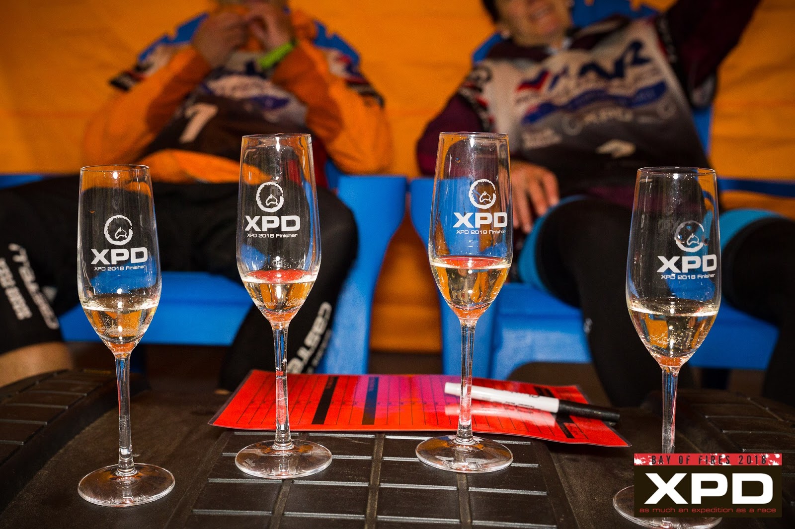
We sat and enjoyed pizza and champagne on the finisher's lounge as we
retold some of our favourite most interesting times out there, then were taken
home to our little house to enjoy hot showers, more pizza and champagne!
 |
| .....and we did it all just for this! |
Mountain Designs Wild Women – Kim Beckinsale, Cass Kimlin
Gina Dunsdon and Alina Mc Master finished in 8th position overall in
a time of 109 hours 20 minutes and 55 seconds and were awarded 1st Female
Team in XPD Bay of Fires 2018.
 |
| Mountain Designs Wild Women - 1st Female Team XPD Bay of Fires 2018 |
Thanks to all our supporters and followers out there who
either saw us on course or were back at home watching our dots, you certainly
helped to keep us going in the right direction…. well most of the time!
Thanks to our major sponsor Mountain Designs for all the
amazing gear we used during the race, we certainly managed to cope well despite
some pretty challenging weather conditions, and we look forward to testing out
some new gear as the brand geos through a period of change.
Also, thanks also to our other major sponsor Ay-Up Lighting
Systems; we certainly made the most of the darkness only having 6hrs sleep in 40hrs
of dark times, there rest of the time the Ay-up lights were helping us to find
our way.
Finally thanks to Tri Adventure for also supporting Mountain
Designs Wild Women and women’s adventure racing in general. If you want to get
into adventure racing or just want to improve your fitness in the great
outdoors, well please look up www.triadventure.com.au
as there is plenty of great support and a super friendly environment to get you
started or keep your adventures alive!
Next up for Mountain Designs Wild Women is the Rogue Raid in
May, followed by Geoquest in June and Hells Bells in September, these events
are part of the Adventure 1 Series.